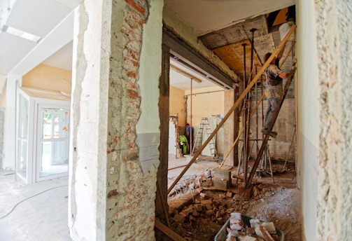
Tundraco's logo, with the words Tundraco's Daily Living Guide in a solid black font on a green background.
Tundraco's Daily Living Guide to Travel

The Kumbrabow State Forest


Home | Book & Product Review Index | Article Index
A picture of Mill Creek Falls
Mill Creek Falls

Destination: The Kumbrabow State Forest
By Rochelle Caviness - August 27, 2004


Located southwest of Elkins, West Virginia, near Huttonsville, the Kumbrabow State Forest is situated on Rich Mountain and consists of a hair less than 9,500 acres. As you travel up the mountain, to the State Forest, you may notice that there has been a great deal of logging and storm damage to the privately held lands that boarder Kumbrabow. However, once you enter the grounds of the State Forest you are greeted by lush woods that provide shelter for the abundant wildlife that calls this forest their home.

Kumbrabow provides a host of recreational activities ranging from hiking and camping to hunting and fishing. For those wishing to stay in the forest, there is a campground with 13 rustic campsites, as well as five rustic pioneer-styled cabins, and one fully accessible cottage. There is no running water or electricity available at the campsites, cabins, or the cottage. Potable water is, however, available from conveniently located hand pumps. A coin operated shower and laundry, located next to the forest's headquarter building, is available to registered guests.

If you plan on visiting this forest during hunting season, and are a non-hunter, be forewarned that hunting is permitted in this State Forest during hunting season. There is however, a 500-foot safety 'No Hunting Zone' around all the facilities in the State Forest. Fishing is also permitted in the forest. West Virginia hunting and/or fishing licences are required.
A picture of the picnic area
A View of the Picnic Area


Outside of hunting season, most visitors to Kumbrabow come to enjoy the scenery - to walk through the woods, enjoy a picnic, or watch for wildlife. Deer, black bears, bobcats, and turkeys are but a few of the many creatures that you might see during your visit. Whether or not you are staying at one of the park cabins, take a detour on your visit and travel down the road that leads to the cabin area. Just before you reach the cabins there is a small parking lot and a sign for the Mill Creek Falls. From the parking area, the 'hike' to the falls will only take you a few minutes. The falls are not very high, but they flow into a marvelous swimming hole, and the view of the falls is very relaxing.


In regard to hiking, there are about eight formal, blazed trails in the forest that traverse a large portion of the forest. There are also miles of fire roads that make for easy hiking. My favorite trail in the Kumbrabow State Forest is the Potato Hole Trail. This trail begins near the Forest Headquarter's building and parallels a portion of the Potato Hole Run. Finding this trail can be a bit tricky. If you go to the headquarters building and walk away from the road, you will pass the laundry/shower building, then a maintenance building. Go around behind the building, behind which is a small shed. The trail starts right behind the shed. There is a sign at the trail head, but you cannot see it until after you pass around the maintenance building - you cannot see it from the parking lot or the road.

The Potato Hole Trail is two miles in length. The first two thirds of the trail are fairly level and it makes for a leisurely walk. I recommend that you hike this trail in the fall or spring when the leaves are off the trees, as you can see the creek that give the trail its name. When the trees are leafed out, you can hear the creek, but not see it. The last third of the trail becomes progressively steeper as the trail heads away from the creek and up to the top of Rich Mountain. When you reach the end of the trail, you can backtrack, or make a loop by coming back down on either Meatbox Run Trail, or the Raven Rocks Trail. The Potato Hole Trail terminates at the end of a fire road. To get to Meatbox Run Trail, just walk down the fire road for about a 1/4 of a mile, give or take a bit. There is a sign for the Meatbox Run Trail on the left-hand side of the road. To reach the Raven Rocks Trail, you need to keep walking down the fire road until you come to a T shaped intersection, and then hang a right (to the north). This puts you on the Rich Mountain Fire Trail. This is an old fire road and it makes for a relatively easy hike, on its own. Walk to the end of Rich Mountain Fire Trail, where you will find a sign for the Raven Rocks Trail.

Both the Meatbox Runs and Raven Rocks trails will take you back to the main road running through the forest. This is a paved road. The walk back the forest headquarters and the beginning of the Potato Hole Trail is about 3 miles if you come back on the Raven Rocks Trail, and about 2 miles if you take the Meatbox Run trail back. Using just these three trails, you can create several very nice hiking loops. If you park at the Picnic area, you'll find the trail head for the Meatbox Run Trail is right across the road from the Picnic area. Now, if I've thoroughly confused you with my directions, don't worry. A trail map is available at the headquarter's office.
A picture of the Potato Hole Trail
The Potato Hole Trail


The last time I hiked the Meatbox Run Trail (early Spring 2004), there was a lot of damaged trees, due to an ice storm, at the upper end of the trail, near to where it connects to the Rich Mountain Fire Trail. Although the trail had been cleared - it was still a gloomy sight. The damage, however, seemed to be mainly confined to one small area. Overall, the hiking trails in the Kumbrabow are well maintained, with clear blazes, and many pleasing vistas.

Kumbrabow State Forest is just one of the many outstanding State forests and parks located in West Virginia. To learn more about West Virginia's State Parks and Forests, visit: www.wvparks.com

Back to top


About Us | Privacy Policy | Site Map | Comments

The information provided on this site is for informational purposes only.
Always consult your doctor for medical advice.


Click Here to Return to Tundraco's Daily Living Guide to Travel Main Index

Text and Photographs - Copyright © Tundraco & Tundraco.com 2003 - 2010 All Rights Reserved